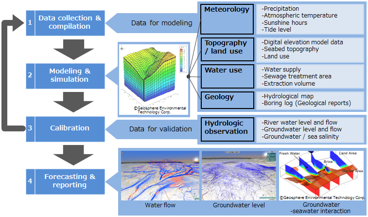
System Configuration
Analysis procedure is (1) data collection/compilation, (2) modeling and simulation, (3) calibration, (4) forecasting and reporting.
Features
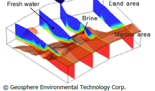
Analysis with 3D-GIS (Geographic Information System) visualization enables observation understanding of current water balance, potential water volume of groundwater, and salinity state.
- WCSS can simultaneously trace the flows of surface water and groundwater
The most prominent feature of the WCSS used here is the function that enables fully joined treatment of surface and subsurface water flows. In the simulation, the interaction of waters on the surface and subsurface is determined by the difference of hydraulic potentials of the peripheral points, so that downward infiltration, upward gushing, and the flow along the surface are modeled naturally and physically.
- Visualization of the simulated results by graphics overlaid on GIS is possible.
As an example, WCSS is able to analyze and visualize (1)streamline indicating the trace of the water flow, (2)the flow quantity that shows the water amount, (3)flow direction of groundwater, (4)distribution of the ground water level, and the salinity distribution in order to understand the border between fresh water and salt water.
- Advantage for Brackish Water RO and Seawater RO
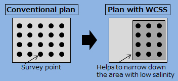
- (1)Survey cost reduction (Brackish Water RO) *2
- WCSS helps reduce the number of surveys compared to conventional plans by narrowing down the survey points such as pumping tests.
- (2)Water cost reduction (Brackish Water RO/Seawater RO) *3
- Seawater RO : Simulating the volume and salinity of the groundwater in inland areas
- Brackish Water RO : Simulating the volume and salinity of the groundwater in the sea bottom spring water area of coastal area.
Cost can be reduced by selecting an area where low salinity water can be stably extracted.

- (3)Forecast (Brackish Water RO/Seawater RO)
- WCSS helps in evaluating the environmental impact and the risk of increasing the facility operation cost, based on scenario studies.
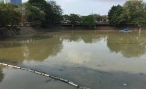
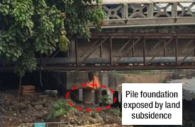
- Scenario A : Draining of water, land subsidence and water salinization by over extraction
Evaluation item : Groundwater volume, level and salinity
- Scenario B : Drain of water by change of weather conditions
Evaluation item : Groundwater volume and level
- Scenario C : Increase of Brackish Water RO facilities in the neighborhood
Evaluation item : Groundwater volume and level
- *2)
- RO : Reverse Osmosis
(In-house comparison)